


Environmental intelligence at street level
Real-time data from mobile sensor networks. Real measurements, not estimates.
The solution
The problem
Sparse static stations mean low-resolution maps and estimated data, not real measurements. Pollution stays invisible where it matters. No real street-level data.
Our approach
Sensors on fleet vehicles, 24/7 collection along real routes, processing in the cloud, delivery via APIs. The solution is one path: from the fleet to the cloud to you.
The Sparrow Nodes Fleet is that solution: fleet, cloud, you.

Nodes Fleet
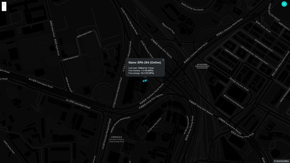
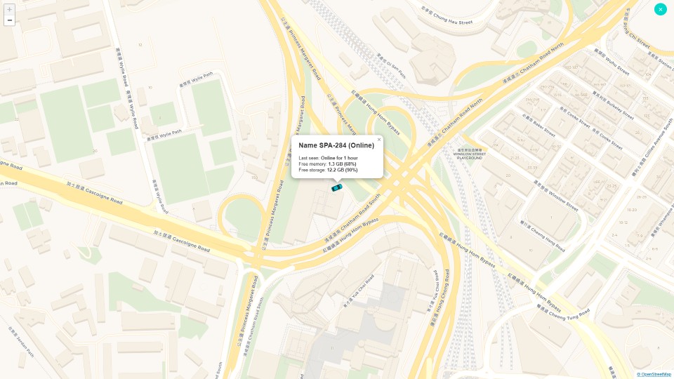
Nodes on vehicles capture street-level data and send it to the cloud.

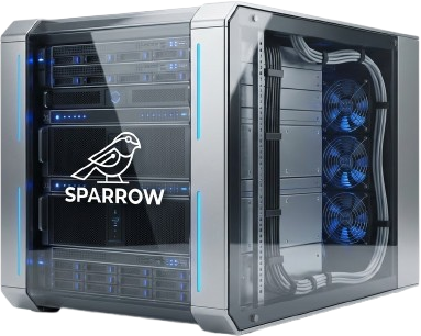
Sparrow Cloud
Processing, storage, and calibration in the cloud.

Data APIs
Validated data available via API for your apps and products.
Meet Sparrow Fleet
A network of vehicles fitted with Sparrow Nodes. They run normal routes while scanning streets and collecting high-resolution environmental data. Each vehicle is a mobile sensing unit for real-time, street-level coverage.
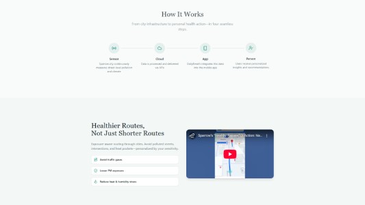
How it works
- 1Partner with fleet operators.
- 2Equip vehicles with Sparrow Nodes. Plug-and-play.
- 3Vehicles run normal routes. No change to operations.
- 4Data collected every few meters, uploaded in real time.
- 5Process and deliver via API.
Physical AI implementation
Sparrow Nodes integrate with autonomous and connected platforms. One sensing stack, multiple deployment modes.
Legged and mobile robots

Deploy Sparrow Nodes on legged or mobile robots for inspections and hard-to-reach terrain.
- Inspections and industrial sites
- Hard-to-reach and off-road terrain
- Environmental data wherever the platform goes
UAVs and aerial platforms
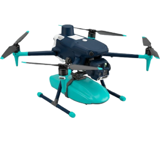
Pair Sparrow Nodes with UAVs for aerial-ground correlation, site surveys, and flexible deployment.
- Aerial-ground correlation
- Site surveys and mapping
- One sensing stack, multiple deployment modes
Why fleet-based monitoring?
Full-city coverage
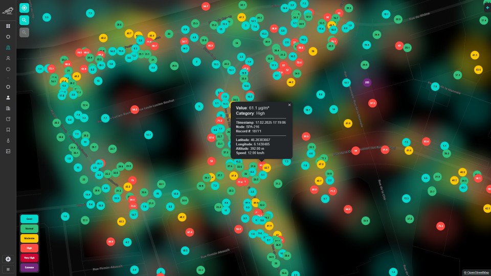
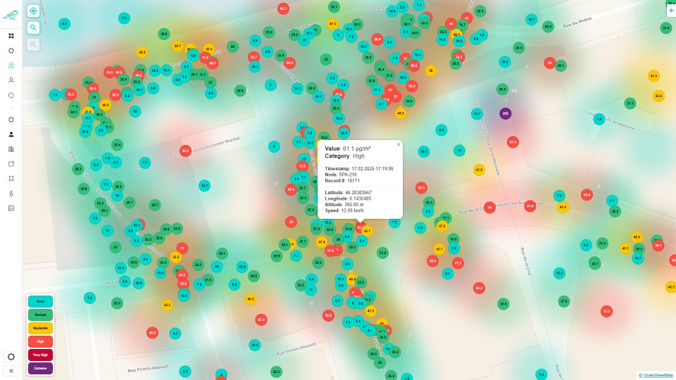
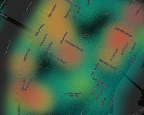
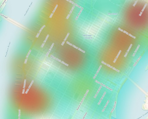
Coverage is what makes the data useful. Fleet vehicles cover entire cities daily, more streets scanned, more often, so your apps get street-level data where it matters.
High spatial resolution
Street-level data instead of a handful of fixed stations. Denser sampling means your maps, routing, and analytics reflect real conditions block by block. Better inputs for your models and user-facing features.
Scalable infrastructure
New city: partner with a fleet, install nodes, start scanning. No permits, grid planning, or large maintenance teams. Scale your data footprint with your business and bring street-level intelligence to new markets fast.
Cost efficient
Lower cost than building stationary sensor networks. Fleet-based collection spreads cost across existing operations. Premium environmental data at a fraction of traditional deployment cost.
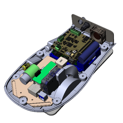
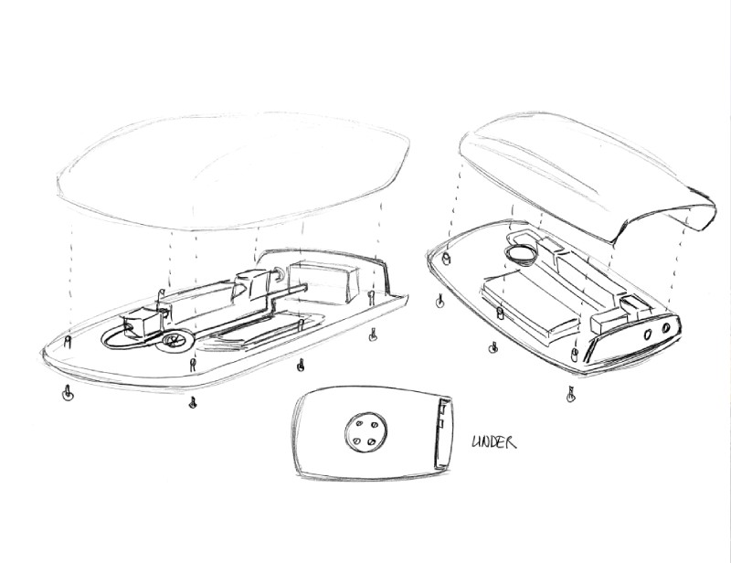
Sparrow Node

What it does
The node is the core of our network. On the vehicle it captures environmental data along every route: air quality, road surface, noise. One device, many signals, continuously.
What it collects
Air: particulates, gases, climate. Road: surface quality and bumps. Noise: exposure and events. Plus GPS. Calibrated sensors, street-level resolution.
How easy it is
Plug-and-play. No structural change to the vehicle. Rugged, built for fleet use. Install and go.
What you get
Real measurements, not estimates. High resolution, frequent, mobile. Data ready for your maps, apps, and APIs.
Our hardware

-
Proprietary & Swiss-made
Full stack in-house. Designed, built, and produced in Switzerland. We control quality and evolution.
-
Lab-calibrated sensors
Sensors calibrated in-lab. Validated air, road, and noise data you can trust and build on.
-
Reliable & plug-and-play
Rugged for fleet use. No vehicle changes. Install and go; reliable in the field.
Sectors
Empowering diverse sectors with accurate, hyper-local, real-time air quality insights to support the journey to eliminate pollution, improve air quality and protect public health.
-
Local Authorities
Evidence-based policies and community engagement with hyper-local, real-time air quality. From sustainability goals to transparent reporting.
-
Smart City Solutions Providers
Hyper-local environmental data for smart infrastructure. Toward responsive, climate-resilient city services and live dashboards.
-
Distributors & Strategic Partners
Extend your portfolio with street-level environmental data. For smart city rollouts and large-scale environmental programmes.
-
Environmental Consultancy
Accurate street-level data for assessments, permitting and due diligence. For public and private sector projects.
-
-
Enterprises
ESG and CSR with real-time air quality at your sites and across communities. Toward credible, auditable reporting.
-
Industrial Sectors
Emissions and air quality monitoring for compliance and risk. Toward stronger ESG reporting and operational control.
-
Healthcare
Outdoor pollution near hospitals and clinics. Toward health-based policies, awareness and protection of vulnerable groups.
-
Construction
Dust and emissions on-site for regulation and community trust. Toward responsible development and fewer complaints.
Sector Playbooks
Deep-dive examples of how Sparrow is used across real estate, public health, fleets and standards bodies.
-
Mould platforms in real estate
Using Sparrow data in mould risk platforms to protect tenants, assets and indoor environments in residential and commercial buildings.
-
Filtering and ventilation in real estate
Connecting outdoor street-level measurements with indoor filtering and ventilation systems to optimise IAQ strategies.
-
Kids breathe better air
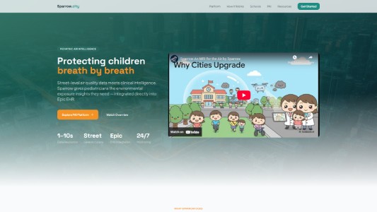
Supporting cleaner air for children on school buses, in classrooms and at paediatric clinics with high-resolution exposure data.
-
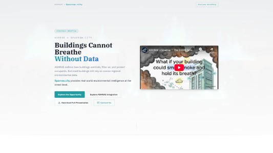
ASHRAE-related sectors
Aligning Sparrow measurements with ASHRAE-relevant use cases and guidance for buildings, HVAC and IAQ professionals.
-
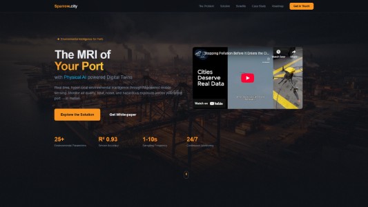
Ports and maritime routes
Applying Sparrow to ports, harbour areas and logistics corridors to map pollution near critical infrastructure and communities.
-
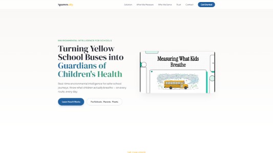
Yellow school bus fleets
Using school bus fleets as mobile sensing platforms to understand and improve the air children breathe on their routes.
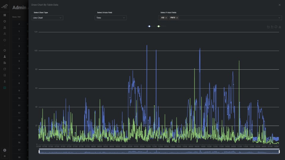
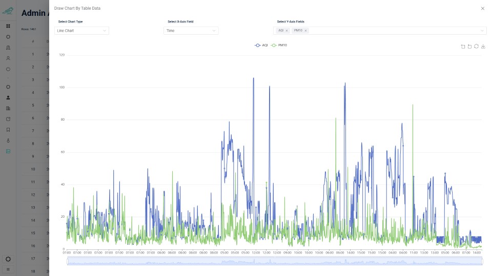
Data & APIs
Global Presence
Street-level environmental data collected by Sparrow nodes worldwide.
0+Gases
0+Particulate Matter
0+Temperature
0+Humidity
0+Noise
0+Pressure
0+IRI
0+Road Bumps
0+
Total measurements*
* Data current as of February 2026.
Coverage
Successful fleet deployments, pilot programs, and integrations in multiple countries.
- USA

- Switzerland

- Germany

- Belgium

- Hong Kong

- Azerbaijan

Sparrow CMS
Central Management System for the Sparrow sensor fleet: manage, monitor, and control devices in real time from one secure interface.
One place to oversee device performance, data flow, system health, and coverage across the fleet. Built for clarity and control.
For cities, enterprises, and data-driven teams, it turns environmental data into actionable intelligence. Visualization, data management, and APIs support operations, planning, and integration into smart city and product workflows.
Available APIs
REST APIs for street-level environmental data. Download each spec below for endpoints, parameters, and integration.
-
Address Hourly AQI
AQI and pollutants for a given address and nearby area. Hourly and monthly.
-
Area Hourly AQI
Air quality over a region. Hourly data for monitoring at scale.
-
Geohash Hourly AQI
High-resolution AQI by geohash. Precise locations, hourly.
-
Zip Code Hourly AQI
Local AQI by zip code. Community-level air quality.
-
Measurements
Raw node data: particulates, gases, weather, road quality.
About us
Sparrow Analytics is a Swiss-based startup, dedicated to exploring new opportunities and executing complex technology projects. Our vision is to become a global platform for data collection, harvesting, and processing for populated environments.
Our History
Sparrow Analytics is a leading provider of air quality data and analysis solutions. Our team comprises experts in environmental science, data analytics, and technology, all dedicated to delivering the most accurate and actionable air pollution information available.

Early prototype in development

First production prototype
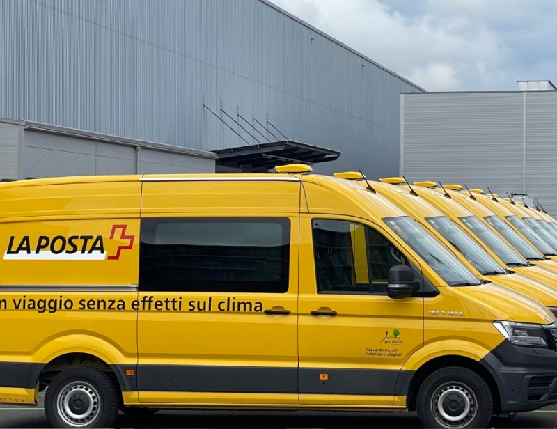
Swiss Post installation

Swiss Startup Award 2024

Evaluating new paint jobs
Where it all started
Founded with the vision of improving public health and urban living, Sparrow Analytics has grown from a small startup into a trusted partner for businesses and organizations.
Our journey began with a focus on collecting high-resolution air pollution data, and today, we offer a wide range of products and services tailored to meet the diverse needs of our clients.
Use Cases & Resources
Explore live use cases and Sparrow materials: dashboards, manuals, specs, and physical AI integrations.
-
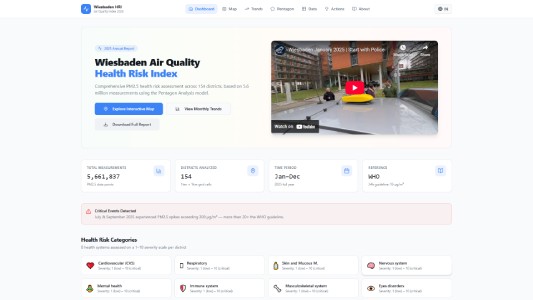
Sparrow at Wiesbaden Health Risk Index
Street-level data for the Wiesbaden Health Risk Index 2025.
-
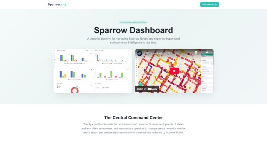
Sparrow Dashboard
Interactive dashboard for visualising and exploring Sparrow environmental data in real time.
-
Sparrow Product Manuals
Product manuals and documentation for Sparrow Node hardware and deployment.
-
Sparrow Product Specs
Technical specifications for Sparrow Node sensors, APIs and data outputs.
-

Sparrow with Physical AI
Sparrow Nodes integrated with physical AI platforms: robots, drones and autonomous systems.
-
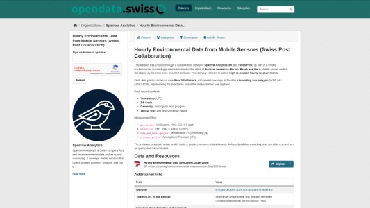
Swiss Post Open Data (Hourly)
Hourly GeoJSON from Swiss Post fleet sensors on opendata.swiss.
Our Values
-
Innovation
Better tech for accurate street-level data.
-
Integrity
Transparent data and methods. No black boxes.
-
Sustainability
Data that supports cleaner air and healthier cities.
Our team


Partners and clients

Google

Esri

Swiss Post

UN Environment Programme

Federal Institute of Metrology METAS

University of Surrey

The Hong Kong Polytechnic University

Swiss Federal Institute of Technology Lausanne

Canton of Geneva

International Telecommunication Union

City of Antwerp

City of Wiesbaden

Port of Antwerp Bruges

Citymesh

Lookmove
Popety.io
Clients & Partner Demos
Sparrow integrations and demos with Amazon, Epic, Headspace, DailyBreath, and more.
-
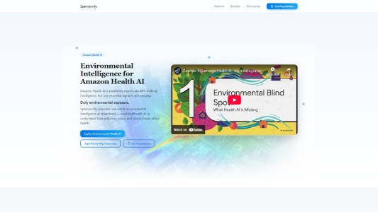
Sparrow for Amazon Health AI
The missing layer: street-level environmental data for Amazon Health AI use cases.
-

Sparrow for Epic with Esri
Sparrow data integrated with Epic and Esri for healthcare and GIS workflows.
-

Sparrow for Headspace Mental Health
Air quality and environmental context for mental health and wellbeing applications.
-
Sparrow Collaboration with DailyBreath
Sparrow and DailyBreath together for breath and air quality insights.
-

Sparrow for Green School Center by USGCS
Environmental data for the US Green Building Council’s Green School Center.
-
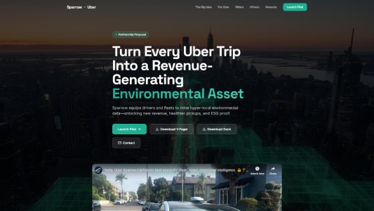
Sparrow for Uber
Street-level environmental intelligence for Uber mobility and fleet use cases.
-
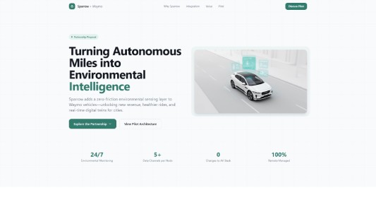
Sparrow for Waymo
Sparrow data for Waymo autonomous vehicle and mapping workflows.
-

Sparrow for Aura Health
Environmental and air quality data for Aura Health mental wellness products.
-
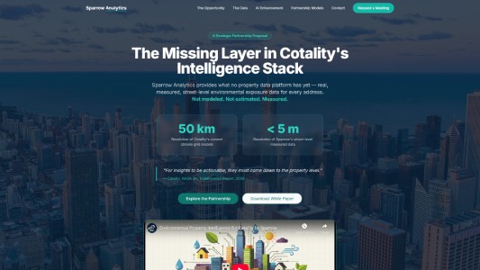
Sparrow for Cotality, Real Estate
Sparrow environmental data for Cotality real estate and property solutions.
-
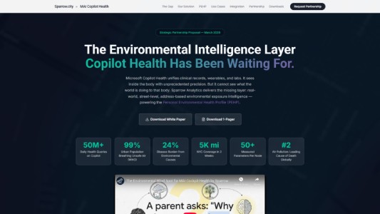
Sparrow for MAI Cockpit Health (Microsoft)
Sparrow integration with Microsoft MAI Cockpit Health for health and environment insights.
-
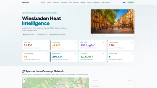
Sparrow for Wiesbaden Heat Report 2025
Street-level data for the Wiesbaden Heat Report 2025: heat exposure and urban microclimate.
-
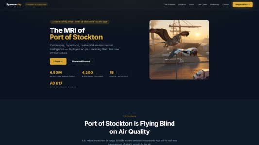
Sparrow for Port of Stockton
Environmental intelligence for the Port of Stockton and surrounding logistics corridors.
Contact
Ready to use street-level environmental data? Get in touch.