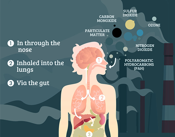
Air pollution is colorless and odorless. Risks associated with air pollution are invisible unless measured. Data is crucial for evaluating and mitigating health risks related to air pollution and their potential impacts.
When choosing home or evaluating location, make sure that you are well informed about the air quality associated with that specific location. Connect to the Air Quality API to enhance effectiveness of your products and solutions.
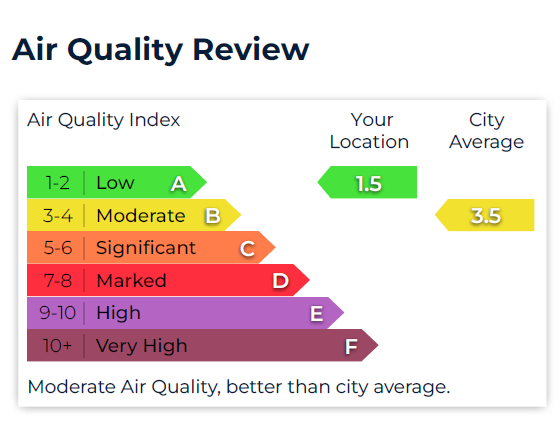
Air Quality Index (AQI) for Real Estate and Insurance
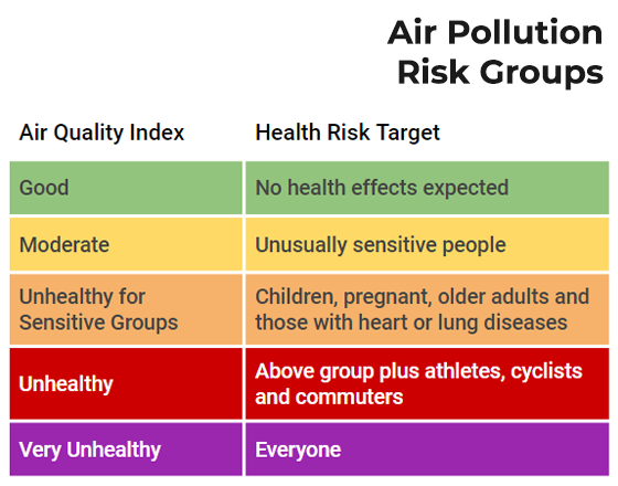
Easy to understand AQI scale
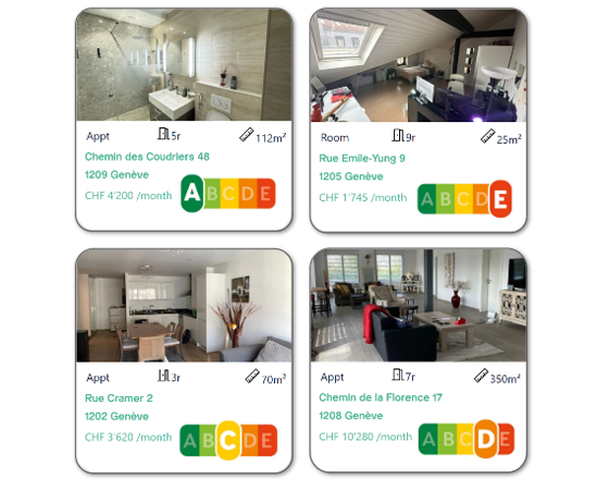
Search and compare Real Estate properties by AQI
Evaluate health at given location
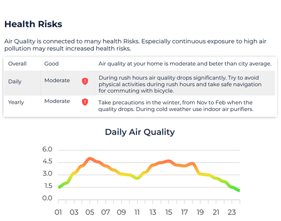
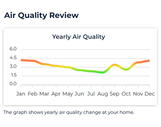
Air Quality Report for corporates and individuals
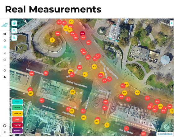
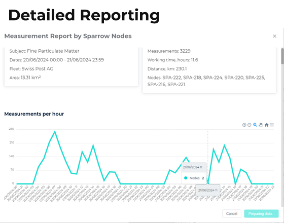
Comprehensive report with detailed data
Yearly and daily charts
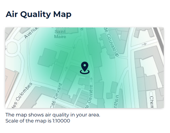
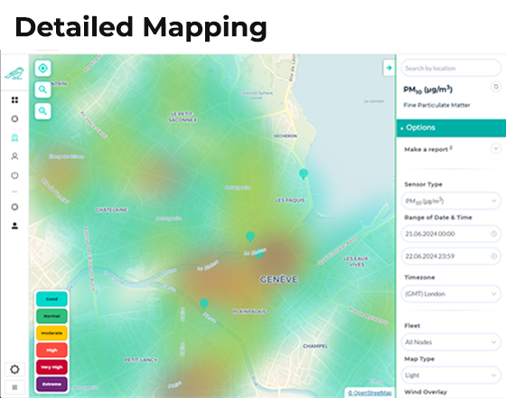
Visual heat map
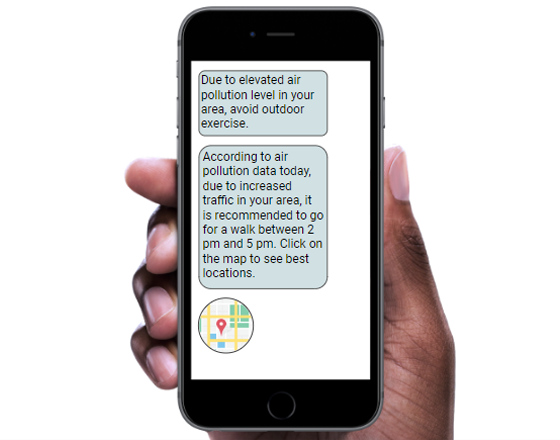
Health Risk Recommendations
AI powered evaluation model
Recommendations in clear text format
Valuable insights to help decision making process
How Do We
Collect Data
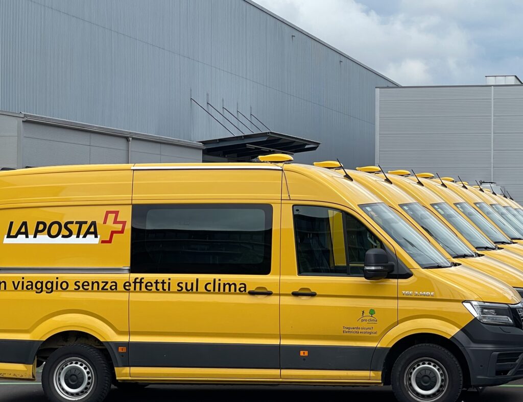
We collaborate with fleet managers to equip selected vehicles with our advanced sensors.
As these vehicles navigate the city, our sensors continuously collect data, which is transmitted to our servers in real-time.
This data is then processed using AI technology to generate actionable insights.
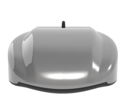
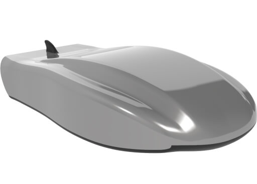
Sensor Node
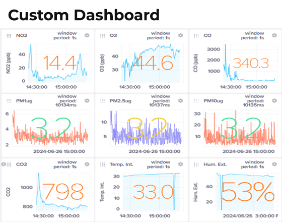
We have developed an advanced mobile sensor node capable of measuring up to 50 different parameters while in motion, utilizing the latest technology.
Air Pollution
Particulate Matter: PM 1, PM 2.5, PM 10
Toxic Gases: NO2, O3, CO2, CO
Temperature
Relative Humidity
Atmospheric Pressure
Road Quality
Determining surface smoothness (IRI)
Bumps and potholes detection (SDV)
Noise Pollution
Exposure and noise mapping
Noisy event detection
System info
Accelerometer Data
Precise GPS and Timestamp
3/4/5G Quality of the Network
Interval: Gas-1 min., PM-10 sec.
Operational from -30 up to +50 C°
Health Risk Solutions
Protect your close ones from the pollution by using accurate and validated air quality data in high resolution. Our proprietary and accurate data combined with AI powered valuable insights will help you to minimize health risks and improve quality of life.
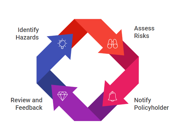
Health Insurance Solutions
Prevention of unnecessary health costs.
Notifying policyholders about worsening air quality.
Educating and increasing customer loyalty.
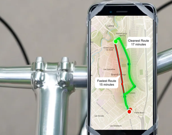
Clean Route Navigation
Choosing alternative cleaner routes.
Easy to implement API models.
Value added for cyclist and runners.
Exposure Tracking
Alerting users to prolonged high pollution.
Tracking unusual change in air quality conditions.
Assessing health impacts related to air pollution.
Health Insurance Solutions
Prevention of unnecessary health costs.
Notifying policyholders about worsening air quality.
Educating and increasing customer loyalty.
Clean Route Navigation
Choosing alternative cleaner routes.
Easy to implement API models.
Value added for cyclist and runners.
Exposure Tracking
Alerting users to prolonged high pollution.
Tracking unusual change in air quality conditions.
Assessing health impacts related to air pollution.
Raw Environment Data
For professionals who require raw data for detailed studies, our comprehensive datasets support a range of applications. Our easy to integrate API provides seamless access to our high-resolution air pollution data.
Applications:
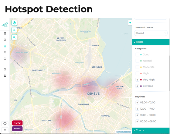
Identify hotspots to plan green areas/traffic rules.
Monitor and manage air quality levels effectively.
Study the impact of air pollution on public health.
Features:
High-resolution data with granular details.
Customizable data sets tailored to specific needs.
API access for seamless system integration.
Empowering Environmental Intelligence Through
Data
We design and build networks of mobile sensors to scan cities, collect and analyse environmental data